10. Where to Bike in Monterey County
This guide, provided as a public service, was first published in 2009, with many subsequent updates. For additional updates, or if you have questions, please contact us. To return to the portal page of the Tips for Bicycling Monterey County 20-section guide, click here.
Wonder what’s meant by the four different types of bikeways referred to on this site? Scroll down to “Here’s what’s meant.” Want something beyond the most typical rides? Scroll to “If you’re inclined to explore.” Want bicycle maps? See Monterey County bike maps.
Besides the wide variety of info on this web page, also refer to Bicycling Monterey’s tips on Carmel and Carmel Valley, downtown Monterey, Pebble Beach, and Seaside. Many people biking an 18-mile stretch of beautiful coastal trail will enjoy visiting—on the north end of that trail—Monterey County’s second-oldest town and the “Artichoke Capital of the World,” Castroville (along with other North County communities). Urban riders enjoy John Steinbeck’s hometown—Monterey County’s largest city and its county seat Salinas, including culturally rich East Salinas / the Alisal. And in the Salinas Valley, “Salad Bowl of America,” new discoveries can be made by biking Greenfield, Gonzales, and other South County communities, including King City, San Ardo, Soledad, and more. And finally, an important tip: although the Big Sur Coast is beautiful, biking Highway 1 it is not right for everyone. If you’re considering it, please first refer to Big Sur tips.
Before you start biking…
- Click here for Bicycling Monterey’s summary of California bike laws; tips on riding skills and safety for children, teens, and adults; and sidewalk laws and other bike-related ordinances for Monterey County (also note the pros and cons regarding safety of sidewalk riding).
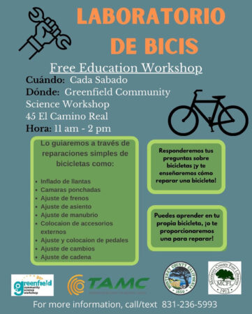
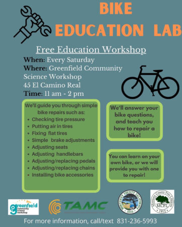
- If you don’ t have a bicycle—or your bike isn’t in good operating condition—see tips on purchasing new and used bikes, renting, and repairing a bike in Monterey County.
- Want to ride with others? The Master Calendar for Bicycling Monterey County includes rides and other activities and events here that are open to the public. Also check our Serious Cyclists section; “serious” is broadly defined and may have just the ride companions you’re looking for. Find yet more people to ride with on Bicycling Monterey’s main resources/bike community page. Or contact Mari.
- Other needs? Check the index to this guide, or contact Mari.
Okay, now for a primer on where to bike in Monterey County, including examples of Class I, II, III, and IV bikeways, and much, much more.
“Where can we bike?”
Where is it legal to bike? You are free to ride a bicycle on all streets and even highways, unless otherwise posted (as provided in CA VC 21960). Note:
-
Freeways or expressways are an exception; you may not ride on most of these! Signs tell when bicyclists must not enter.
-
A second exception is some bridges; watch for signs indicating no bicyclists.
Californian law leaves it to local jurisdiction as to the legality of biking on sidewalks. Learn about local ordinances on sidewalk riding, and more, for Monterey County cities and unincorporated areas.
Okay, so that’s the legal stuff. And where will you be most comfortable, especially if new to biking in Monterey County? Below are some specific recommendations, including the routes most appealing for biking with children.
As mentioned in Why Bike, and as is most widely recognized about biking Monterey County, on the Monterey Peninsula there are many miles of bike paths, lanes, and routes. Click here for bike maps.
Most popular is Monterey County’s Monterey Bay Coastal Recreation Trail, which is part of the Monterey Bay Sanctuary Scenic Trail network. This 18-mile portion stretches from Castroville to Pacific Grove, and with a few exceptions, is Class I (no motor vehicles). As local resident and Monterey County Herald columnist Mike Hale wrote in The Grub Hunter: The trail to somewhere — in search of the best bites on the Monterey Bay Coastal Recreation Trail, 10/26/16: “One can take in the vistas leisurely, not speeding by at 70 mph on the highway — and that connection to air, land and sea is palpable.”
Learn more about that network: Click here for a Transportation Agency for Monterey County brochure about the Monterey Bay Sanctuary Scenic Trail network, and click here for TAMC’s Master Plan. For some Santa Cruz County Regional Transportation Commission resources about this inter-county trail network—which will eventually stretch from the San Mateo-Santa Cruz County line to Pacific Grove in Monterey County—refer to SCCRTC’s webpage “Monterey Bay Sanctuary Scenic Trail Network (Coastal Rail Trail).”
The Monterey County seat
Most people don’t realize that there are 95 miles of connected bikeways in the Monterey County seat and largest city, Salinas. This includes some Class I areas too—see biking Salinas to learn more. Many people miss out on biking the many wide, flat streets of Salinas that are in low-traffic areas. Bicycling can make exploring the Monterey County seat much more fun! Get a glimpse in Mari’s two-minute audio, “Bikes are taking to the streets–and it’s not where you might expect.” Then check out “Vacation or Staycation: 16 sweet spots in the Monterey County seat.” And watch for Ciclovía Salinas dates, when a section of streets is temporarily closed to motor vehicles.
In addition, there are many other terrific bike paths, lanes, and routes throughout the county. Check out the maps section, and keep reading for more ideas.
Many popular attractions are in very bikeable neighborhoods, as Monterey County’s world-renowned annual 4-Day Celebration of Cycling, Sea Otter Classic, points out.—For an overview in the 2017 SOC “Riding Your Bike” section, scroll down to “Riding Monterey Trails & Backroads [a misnomer].“
Sometimes stamina or schedule don’t allow biking as much as you would like. Refer to our “Bike-and-Ride” section. Even biking just partway to your destination has many benefits.
If you’re a serious cyclist, looking for the more challenging rides, scroll right down to “If you’re inclined to explore.” Refer also to the Serious Cyclists section of this guide.
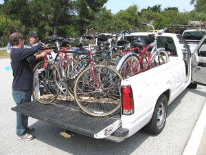
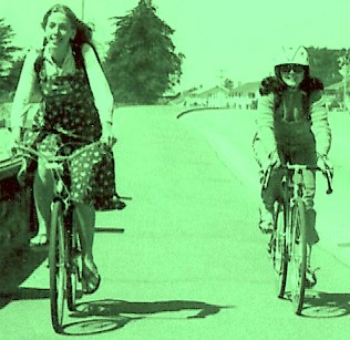
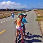
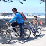
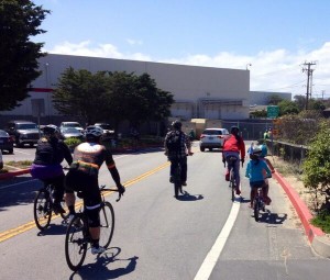
 The Hernandez family of San Francisco—Antonio, Elias, Marco, and Christina—all set to head out on MoCo’s bike/multi-use path!
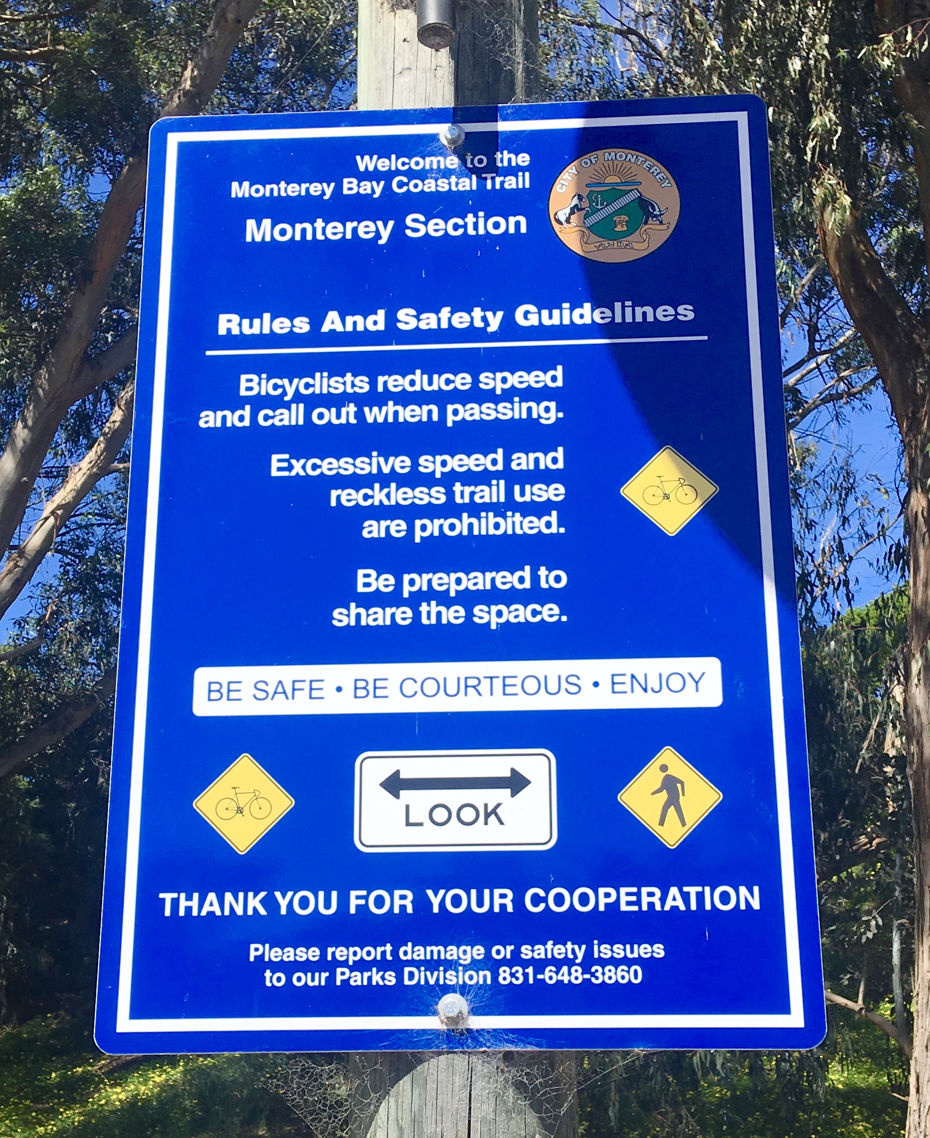
But first: wanna be loved on the bikeways?
Kindly heed the signs (stay in the proper lane).
And don’t be surprised if you are biking along at a leisurely pace (or walking) and you hear, “Passing on your left!” That’s a request to please keep to the right, staying out of a faster cyclist’s way. (Please refer to “Share the trail–for harmony and safety” in our Riding Skills, Safety, and Bike Laws section, and keep in mind that some people may comprehend a language other than English, often Spanish.)
Here’s what’s meant by the four different types of bikeways referred to on this site. Also see photos below.
These definitions for Class 1, 2, 3 are provided courtesy of the Monterey County Planning Department glossary / http://www.co.monterey.ca.us/planning/major/eastgarrison/SP/1440SP_07_Glossary.pdf
-
Class 1 Bikeway (Bike Path): Provides a completely separated right-of-way for the exclusive use of bicyclists and pedestrians. (Note: With crossflow by motorists minimized. When on Class I bikeways, you may still reach some places with motor vehicle cross-traffic. Adult supervision of children is still important.)
-
Class 2 Bikeway (Bike Lane): Provides a striped lane for one-way bike travel on a street or highway.
-
Class 3 Bikeway (Bike Route): Provides connections to either Class 1 or Class 2 facilities/bikeways. Class 3 facilities have no special lane markings, and bicycles share the roadway with motor vehicles.
-
Class 4 Separated Bikeway (Protected Bike Lane): Learn more on the Bicycling Monterey website here.
1. Bike paths

 Five-year-old Joshua Santos of the East Bay
Joshua’s wise parents know that Monterey’s Class I paths are one of the best places
—and with beautiful views!— where Joshua can build up cycling skills and confidence.
Remember: When on a Class I bikeway, you may still reach places with motor vehicle cross-traffic. Adult supervision of children remains important.
2. Bike lanes
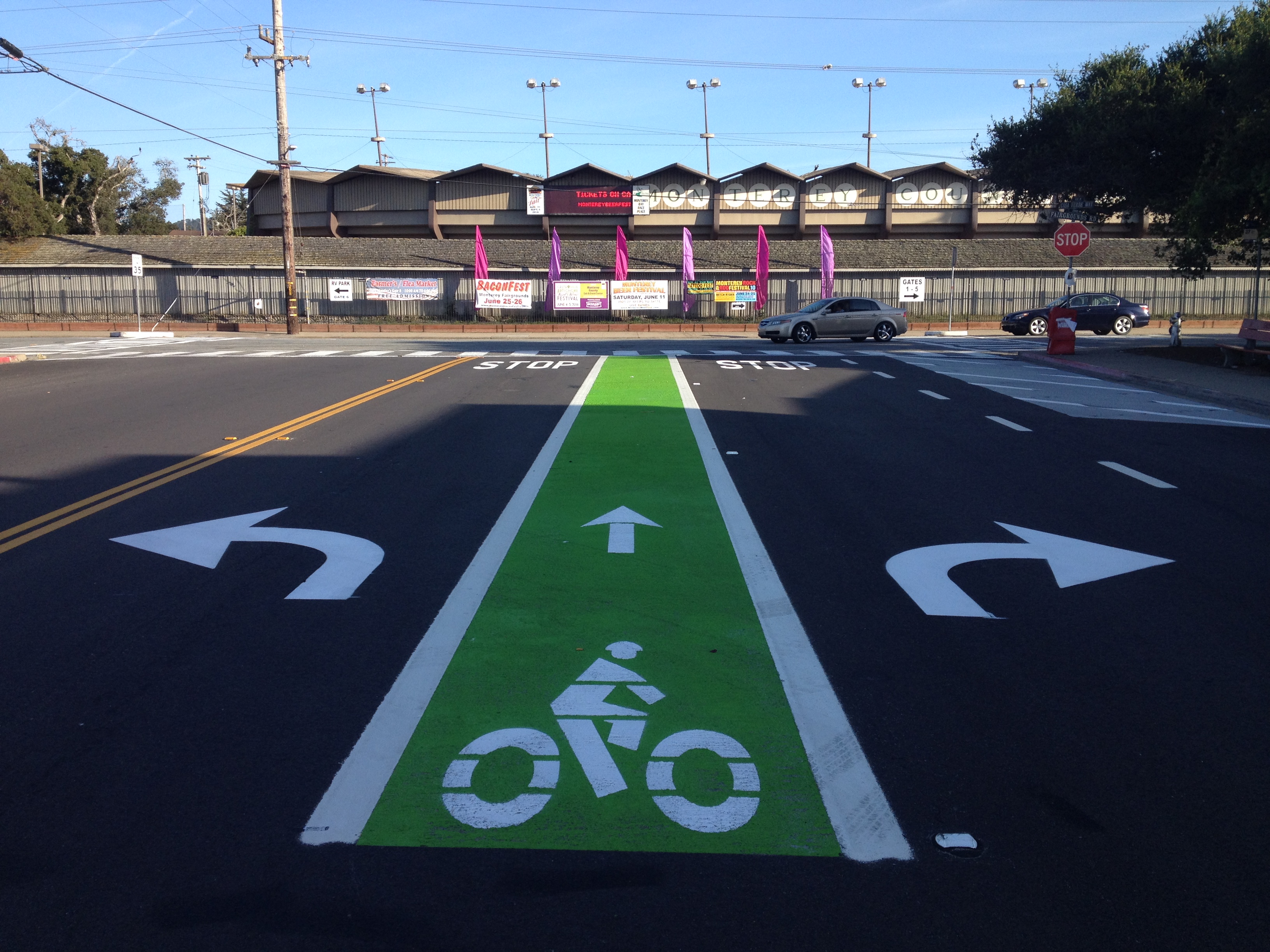
A few bike lanes are even painted green, like this one on Casa Verde in Monterey, heading to the Monterey County Fair and Event Center.


The bike lane above leads from Monterey’s Wharf II, and will cross Del Monte Avenue.
Across Del Monte, on your right, is the City of Monterey Sports Center. Just beyond it is Jacks Park.
If you’re biking in downtown City of Monterey, click here for tips about the plazas.
The bike lane below, along Canyon Del Rey,

takes you to the Del Rey Oaks Frog Pond Wetland Preserve (at left; entrance is between the two parked cars).
Caution signs like the one below
appear in places such as the exit from the state beach parking lot next to Monterey Beach Resort Hotel, where the exit for cars crosses the bike path. It’s just one of the many signs of a bicycling friendly Monterey County!

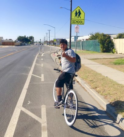
3. Bike routes

 This bike route sign directs cyclists
on the suggested route through this busy area of Salinas.
4. Protected bike lanes
Class 4 Separated Bikeways (Protected Bike Lanes) vary widely in design. Learn more on the Bicycling Monterey website; click here.
Pictured below, a Class 4 buffered lane added in 2017 on East Market Street, Salinas. In 2018, the same type of Class 4 lane (no physical barrier, just pavement paint) was added on a small portion of Del Monte Avenue in the City of Seaside. Still under construction as of March 2019: Class 4 with physical barrier on Fremont Street in North Monterey.
* * *
To contribute to the Bicycling Monterey work, and for FAQs, click here. Thank you.
Where to bike?
Here are some possibilities….
If you’re biking with children, you’ll likely prefer all off-road bike paths, such as the following. These include most of the 18-mile Monterey Bay Coastal Recreation Trail, which is a a very popular portion of the Monterey Bay Sanctuary Scenic Trail Network that will eventually reach from the Santa Cruz-San Mateo County line to Pacific Grove.
But first, a reminder: especially when biking with babies and young children who aren’t pedaling, but are riding in a carrier or trailer, etc., little ones enjoy opportunities to hop off and play. City of Salinas parks, City of Monterey parks and beaches, and other local parks, and beaches, make great places to stop. The dad in the video below stopped at a historic site in the city of Monterey, the Custom House Plaza.
http://twitter.com/BikeMonterey/status/627649386680463360
Now, on to those possibilities…
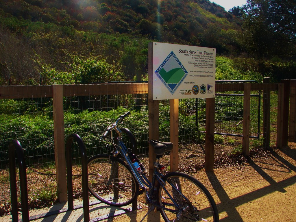
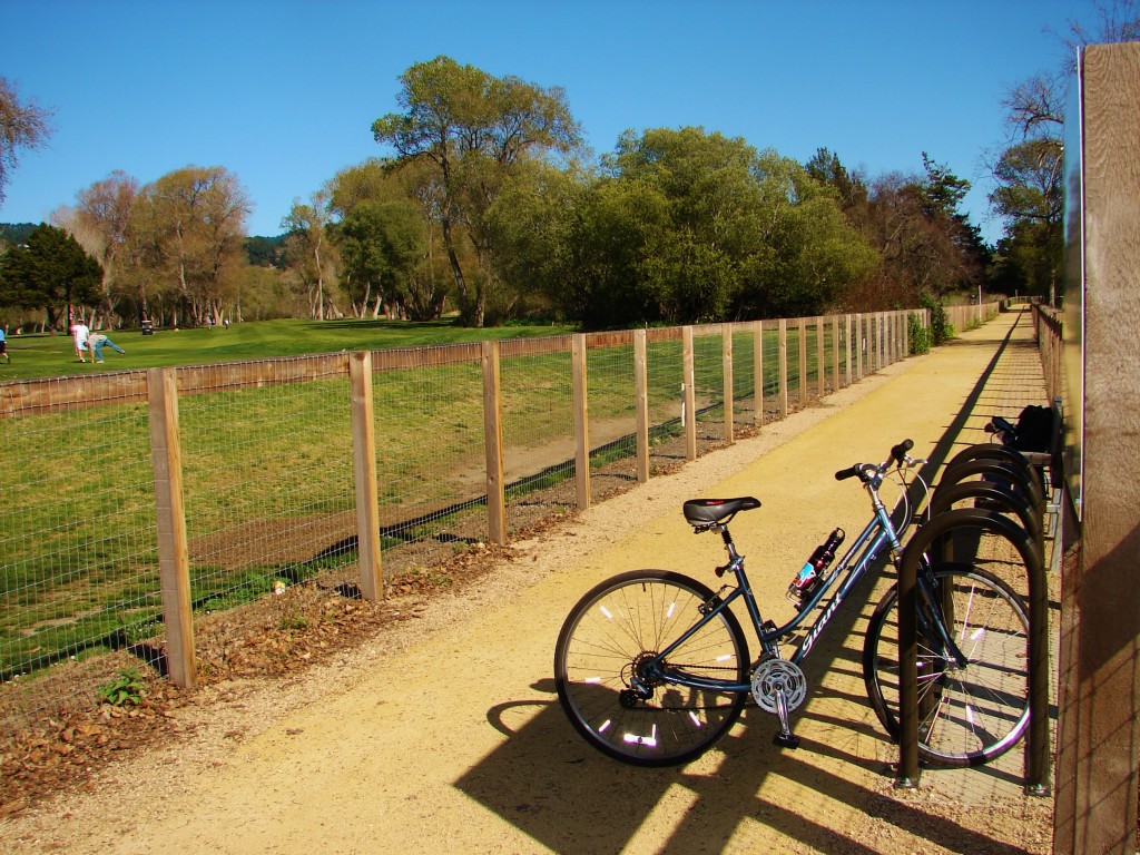
- South Bank Trail along the Carmel River, a beautiful 1.5 mile bicycle and pedestrian path, opened October 2011. Visit the Big Sur Land Trust webpage “’South Bank Trail’ offers new recreational opportunity and connection to public lands as part of ‘Experience Carmel River’” for detailed information.
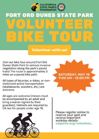
- See Fort Ord Dunes State Park notes under “If you’re inclined to explore” on this page.
- Castroville residents and visitors appreciate the Class I trail extends to North County. Touring cyclists in the vicinity on most any Tuesday are also happy to come upon Kermit the Road Angel–AKA Paul Aschenbrenner, former Hartnell College sociology and psychology instructor–who “puts out the welcome mat” for people biking in North Monterey County. Click here to learn more.
- Monterey Bay Aquarium on Cannery Row, Monterey to Lover’s Point, Pacific Grove. This is not only off-road, it also has separate lanes designated for pedestrians (unpaved) and cyclists (paved). Beautiful views of the bay all along the way.

- Wharf II, Monterey to Roberts Lake, Seaside (runs parallel to Del Monte Avenue). Starts at Wharf II alongside Window-on-the-Bay Park, then cuts through the wooded area opposite the Naval Postgraduate School. Approximately opposite Napa Auto Parts (you’ll see it across Del Monte Ave), there is an option to go up a hill and along the coast (staying on Class I path).


- A different option is to continue straight when you reach that cut-off approximately opposite Napa. If you continue straight, you can bike behind Roberts Lake, then go under the freeway (walk bikes with children) and come out at the beach next to Best Western Beach Resort Monterey. The Class I (off-road) bike path picks up there again. (If you’re up for more biking, see “Fort Ord Dunes State Park” below.)
- You might want to take a “beach break” at Best Western Beach Resort Monterey. The hotel beach is a public one, and there are restroom facilities available just outside the entrance to their upstairs restaurant. If you’re hungry, order food in the restaurant— or in their lobby-level bar, where you may ask to be served there or out on the deck if you prefer. All three dining spots have a lovely view of the bay.

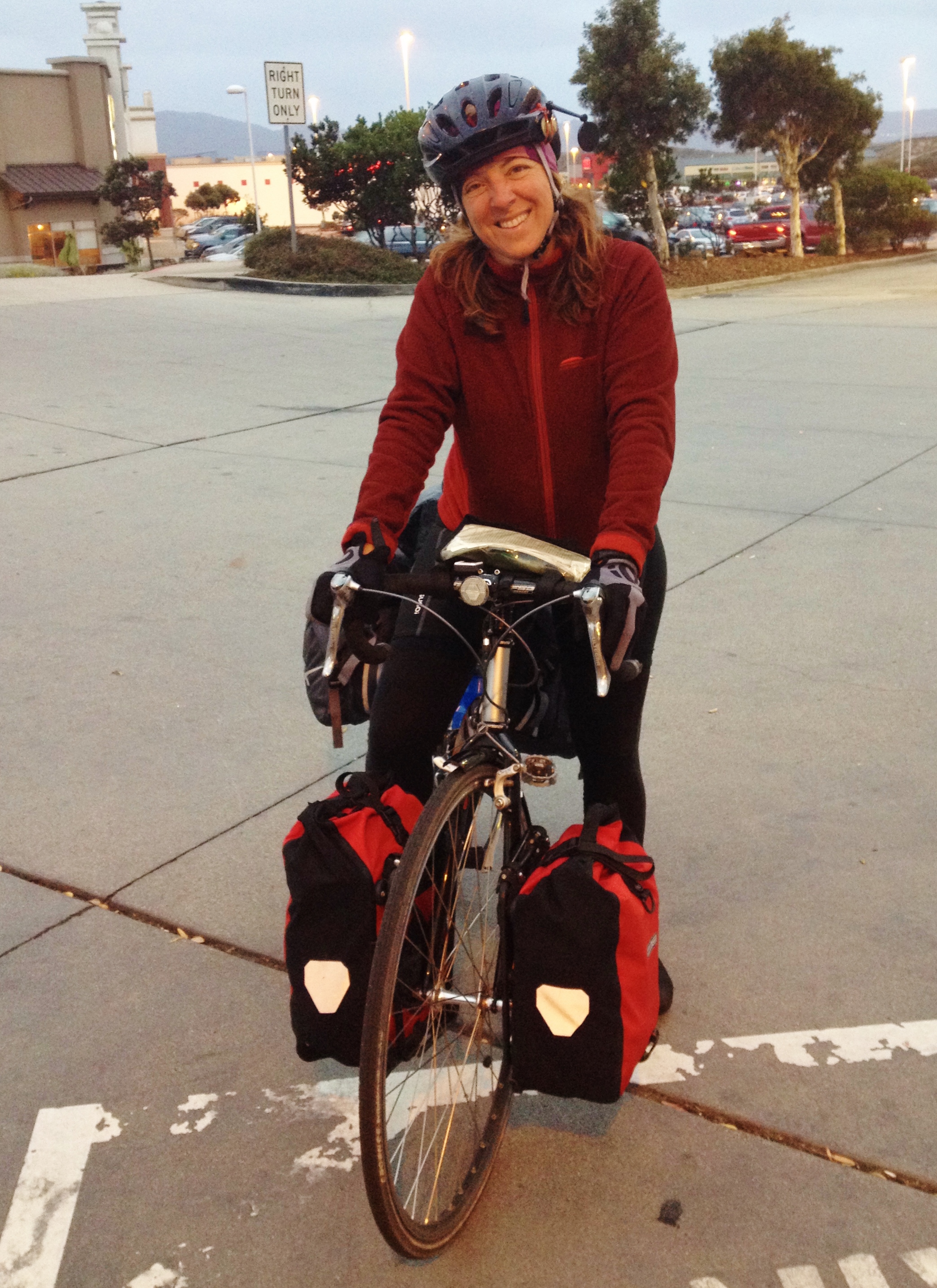
A Monterey County cycling regular and a resident, this woman is heading north on the Wharf II to Roberts Lake stretch of the bike path.
Here she has just passed the point where the path intersects with Casa Verde.

Yes, just as their oceanfront deck sign says, there is Public Access
to Beach Resort Monterey during these hours.
It makes a great rest stop when heading north of Monterey on the bike path.
Another off-road bike path (Class I), but one that’s sometimes impacted by heavy pedestrian traffic:
- The journey from Roberts Lake, Seaside to Lover’s Point, Pacific Grove is all off-road bike path and runs through popular attractions, such as the wharf areas and Cannery Row. There is this caution: if you prefer to avoid biking where there are many pedestrians on the path, there are peak times when you may want to hop off your bike and walk it for the section of path between Wharf II and the Monterey Bay Aquarium. Once past Wharf II to the north, and usually after the Aquarium to the south, you will be able to bike again without having to dodge so many walkers. [This tip is offered with appreciation for my sister, Floann. When she was biking with me here, she reminded that she wasn’t as at ease as I am making her way through pedestrian traffic. Thanks, Sis!]
Partly off-road bike path (Class I)/partly on-road bike lane (Class II) or signed bike route (Class III):
Safety reminders: When using bike lanes/routes (on roads shared with cars), it is recommended to use high-visibility clothing and accessories; trailers and recumbents especially benefit from use of hi-vis flags. At dawn, dusk, or night, or in heavy fog, be sure you have the lights and reflectors required by law; see Biking in the Dark.
If you plan to bike 17-Mile Drive or other parts of Pebble Beach, see this site’s post, “Bicycling Pebble Beach,” for specific tips.
- One of the many virtually flat rides with beautiful ocean views goes from the Monterey Bay Aquarium, Monterey to Point Joe, Pebble Beach (and farther south). There’s a brief, very gentle uphill stretch after Asilomar State Beach. (1) Start at the Aquarium and bike to Lover’s Point (as mentioned above, this stretch is all off-road bike path, and it even has separate lanes for pedestrians and cyclists). (2) Then, from Lover’s Point to Asilomar Avenue, you share the road with cars, and this is a signed bike route only (there is no marked bike lane). (3) After Asilomar Avenue, a bike lane is re-established (still shares the road with cars); the bike lane continues into Pebble Beach, to Point Joe and beyond.
- Note: It’s easy to locate the Pacific Grove gate into Pebble Beach; it’s a right-hand turn at the stop sign after you’ve passed Asilomar State Beach, the Fishwife Restaurant, and the Russell Service Center, which features a retail shop for Peninsula Potters.Once you reach the Pebble Beach entrance gate, follow signs to Point Joe. Biking bonus: except during some of the special events like golf tournaments, cyclists can bike into any Pebble Beach gate. And bicyclists enter for free! (Motor vehicle drivers pay.)
While taking photos, this recumbent has exited the bike path (paved portion)
and parked on the pedestrian walkway (gravel/dirt portion) of the divided multi-use trail at Lover’s Point.


* * *
If you found information on
the Bicycling Monterey website valuable…
Please consider making a contribution to help maintain and expand these resources. Thank you.
* * *
If you’re inclined to explore….
- Start here for some popular bike maps for Monterey County. For more, see the Tips for Bicycling Monterey County 20-section guide’s section “Once You Start: Bike Maps and More.” Bike maps available include Transportation Agency for Monterey County’s countywide map, City of Salinas, CSUMB, Fort Ord/BLM, and more.
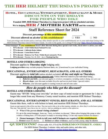
- Many of the individual listings for the hundreds of HER Helmet Thursdays participating locations include bike-there tips, and some are quite detailed. To quickly locate an individual listing, refer to the Quick Reference Guide on the HER Helmet Thursdays LISTINGS/Map/FAQs page. The Quick Guide includes all participants. There is also an auto-generated map, on which nearly all locations show up. Participating locations are in Monterey County cities and unincorporated communities / census-designated places including Big Sur, Carmel and Carmel Valley, Castroville, Corral de Tierra, Gonzales, Greenfield, King City, Marina, Monterey, Moss Landing, Pacific Grove, Pajaro, Salinas, San Ardo, Sand City, Seaside, and Soledad.
- Speaking of Soledad, the City of Soledad received a 2008 Transportation Excellence Award for their bicycle lanes. Trying out those lanes, and visiting Soledad HER Helmet Thursdays spots like Hahn SLH Estate Winery, La Plaza Bakery & Cafe, and Marisco’s Puerto Nuevo, are good reasons for visitors and residents alike to explore the Soledad area by bike.
- Biking around town in the City of Monterey? For a quick overview of existing bikeways, refer to page 18 of Monterey’s 2009 Bicycle Transportation Plan. Like to bike where vehicle traffic is slower? In 2016 City of Monterey provided this speed limits map.
- Down on Cannery Row? Outside the Bay Bikes shop, located directly on the Cannery Row bike/multi-use path, there’s a large sign that lists some biking points of interest, along with mileage for each.
- Fort Ord Dunes State Park is a spectacular place for those who want a very safe place to bike (miles of Class I path) yet with wide open spaces (no heavy pedestrian or bike traffic–yet anyway!). Biking it with a group your first time can be fun, such as during the Intergenerational Ride for Bike Month that took place annually from 2012-2015. Or, if doing it on your own, here are some tips: (a) This is terrific for families with children. Please observe proper lane usage (easy on this boldly striped 3-lane bike/multi-use path). Why? Unlike the bike paths in town, these wide open bikeways are also a suitable place for cyclists who want to zip along, whether because they’re touring and need to make miles, or are racers in training, or just someone loving the joy of speed. (b) The Fort Ord Dunes State Park bikeways are also great for those who are less inclined to stop at restaurants and enjoy the bustle of town, and who would instead prefer packing a picnic and riding where a fair bit of solitude is ensured. (This isn’t a remote location though; it’s parallel to Highway 1, so in some areas, you’ll hear the hum of motor vehicle traffic in the distance.) There are occasional picnic tables alongside the path; please pack out your garbage. There are restaurants in Marina, not far from the Fort Ord Dunes State Park. Here’s how to reach them:
Coming from the parking lot, bike north on the Monterey Bay Sanctuary Scenic Trail, and watch for a cluster of signs just after a short hill, reading: (1) “Welcome to the Fort Ord Dunes section of the Santuary Trail,” with text and drawings; (2) “Fort Ord Dunes State Park”; (3) a directional sign reading “City of Seaside & Beach Access” / “Sanctuary Scenic Trail/Monterey Bay National Marine Sanctuary” with an arrow pointing to indicate Seaside & the beach access are south.Exit the Monterey Bay Sanctuary Scenic Trail by that cluster of signs, going outside the chain-link fence. Turn left (go north) on another bike path. You will be leaving the beautifully maintained path that was paved and striped in 2011, but entering another Class I bike path, the George Takahashi Bicycle Path.Bike on the George Takahashi Bicycle Path a short distance, and you’ll see you are parallel to Del Monte Boulevard. The first traffic signal is Reindollar Avenue. Got kids? Remind them to press the crossing button, since vehicle traffic is coming off the freeway here. (c) When it comes to the dunes or beach at Fort Ord Dunes State Park, bicycles are not allowed. Be aware that much info found online–even posted by well-known publications –is not accurate. And with state budget restrictions, even the .gov info may be outdated. For directions help, ask a local: phone Bicycling Monterey or a local bicycle shop or one of the other Monterey County bicycling resources. - The old Fort Ord (now Fort Ord National Monument) is very popular with Monterey Off Road Cycling Association (MORCA) and other mountain bikers. This land was a U.S. Army base and is now the home of California State University-Monterey Bay. Besides referring to the BLM maps in the “Once You Start: Bike Maps and More section, make use of MORCA’s personal help. Regarding what sections of Fort Ord are open for cycling, and at what times, MORCA is a terrific local resource; refer to http://www.morcamtb.org/trails/
- Fort Ord is popular with roadies too. Why? There are many miles of paved roads where cars are not allowed. Refer to the BLM website at www.blm.gov/ca/st/en/fo/hollister/fort_ord/_recreation_.
- Enjoy history? Among the tips found in “Cycling to Monterey County’s History Spots” is an 11-Mile Fort Ord Bike Ride that was part of the 3rd Annual Fort Ord Warhorse Day (2013) festivities. Margaret Davis of Friends of the Fort Ord Warhorse graciously provided written directions for this ride; click here. There you’ll also find highlights of the ride in a 7-minute, 27-second video “Warhorse Day Bike Ride Fort Ord 2013” by Lynn Moimboissee.
- Speaking of Fort Ord, are you thinking of going to school at CSUMB? As referred to in this CSUMB post on this site, you may connect with others in the CSUMB cycling community, and learn about rides on and around the campus, via CSUMB’s own bike resources, which range from handcycle to bike social events and mechanical help. On this site, the CSUMB-specific bikeways map, in Spanish and English, is in the “Once You Start: Bike Maps and More” section.
- Toro Park, Salinas is another favorite for mountain bikers. Respect signs on public lands regarding bicycle access and bike parking, trail restrictions, and more. Please also bike polite (“spirit of howdy”) on shared trails.
- Garland Ranch Regional Park, Carmel Valley has limited mountain biking in the Cooper Ranch area only. As with all parks, check with the park management for any updates or changes.
- About Jacks Peak Park: you may bike only on the paved road. Bicycles are not allowed on the trails. Please respect these and other park regulations that help protect this beautiful sanctuary, which is the largest native stand of Monterey Pine in the world.
- Best 10 Seconds of Biking Bliss, according to the Monterey County Weekly’s 2015 Editor’s Picks: Eucalyptus Alley, Anzar Road, Aromas.
- You may want to investigate the recommendations of other cyclists who’ve posted on Map My Ride or Bikely.com.
- Released in March 2010, Google Maps Bicycling Directions can be helpful too. We can all make these directions more accurate by contributing corrections and alternate routes. The more people who help Google out, the better their bike directions will become.
- Sharing tips about landmarks, one-way streets, typical wind patterns, elevation changes, and neighborhood pitfalls can benefit others a lot. Feel free to contribute a guest post to this site about a fav local ride.
Biking the coastal trail north of the City of Monterey?
Great, it’s fantastic!
Note this tip:
A woman from Quebec, spotted in Sand City on October 3, 2015, was making her way along the “beautiful!” coastal trail, headed to camp at Veterans Park in Monterey, a spot popular with many visitors who bike.
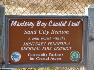
 This Canadian visitor was spotted where the Class I coastal trail has a brief interruption in Sand City by the two large shopping centers—Edgewater and Sand Dollar.
See “Tioga” area on bike map. Signage helps reconnects you to the trail, and as of October 2015, it is anticipated that new Wayfinding signage will soon make it easier for people to follow this route.
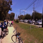
The three pictures below are from this vicinity. In this photo (taken on an Intergenerational Ride), the people are biking from the north, headed south.

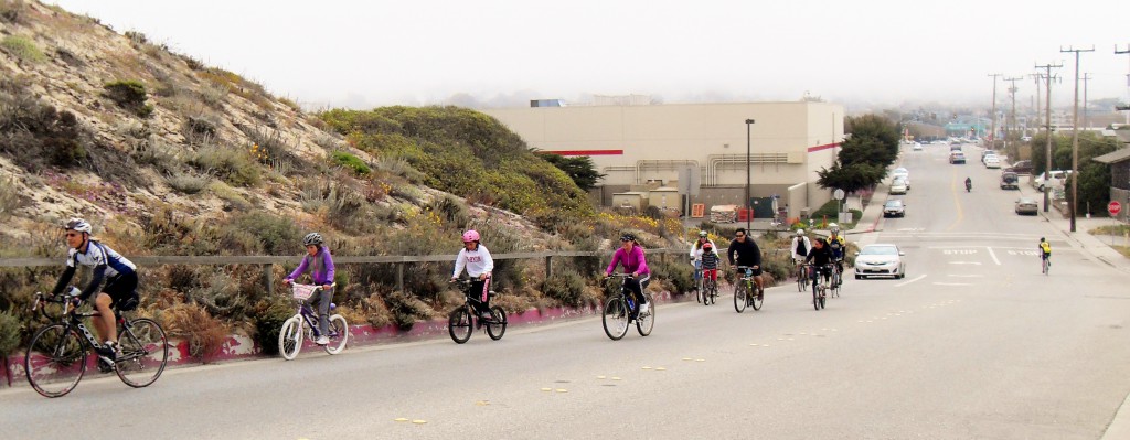
Then you’re quickly back on Class I (no cars) trail.
Ten favorite rides from two local bike community leaders
Here’s a March 30, 2010 update, in honor of the 20th Anniversary of the Sea Otter Classic:
Skip Leatham, Expo Services Director of the Sea Otter Classic, and Frank Knight of Adventures by the Sea sketched out ten of their favorite rides for the Monterey County Convention and Visitors Bureau; check out their recommendations at MCCVB’s See Monterey site.
As mentioned in Bicycling Monterey’s Maps section, maps for some popular rides, such as the 100-mile ride commonly referred to as the “Monterey Loop,” can be found in the “Ride Maps” section of the Velo Club Monterey website.
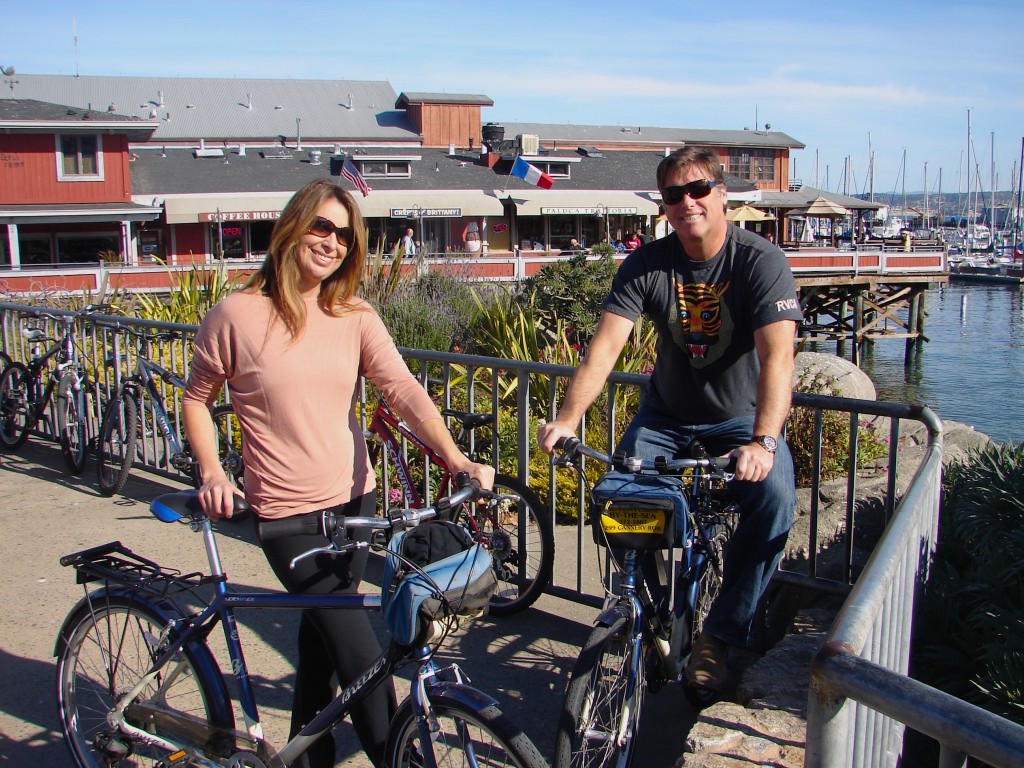
 This visitor was quite sure of his favorite way to see Monterey County: leave the car behind, and head out on the bikeways!
Steinbeck Country
Rick Gunn’s story for Adventure Sports Journal tells of the experience that he, Gary Cronk, and Eric Jarvis had bike touring Steinbeck Country.
For more on Steinbeck, see “Bike Salinas: What to do in the Monterey County seat,” or “Cycling to Monterey County’s History Spots.”
A visitor’s verdict on cycling Monterey to Carmel and back
I often tell visitors who ask “Why bike?” that bicycling really is the best way to see this area. Don’t just take my word for it though.
“Cycling is the best way to see Monterey and Carmel,” Jody Brooks reports, writing on June 8, 2010 of the tour he and his wife had just enjoyed. Check out Jody’s report, “Cycling Monterey to Carmel and Back,” published on the Plan Bike website.
His report references several of the HER Helmet Thursdays spots too, including East Village Coffee Lounge in Monterey, Forge in the Forest (AKA the General Store) in Carmel, Toasties in Pacific Grove, and the Vista Blue Spa at the Monterey Plaza Hotel & Spa.
Or, bike-and-ride
Some people, as did Daniel Grün of Germany, like to make that a one-way trip, then take a bike-and-ride option for the return. Daniel rented a bicycle and biked from Monterey to Carmel, via Pebble Beach. Happy but tired, he made use of the Monterey-Salinas Transit/MST bus for the return trip; see tips on taking your bike aboard the MST in the bike-and-ride section.
Where to bike in Carmel
Check out this site’s tips for bicycling Carmel, with extra tips for dog-lovers too.
Caution: Routes for the more experienced—and not for children
Some potentially dangerous routes–best left to the more experienced cyclists–are on the bulleted list below. If you want to enjoy these routes, please first see the linked tips offered on this site and also consider checking in with resource people found in the “Serious Cyclists” section of this guide.
Using high visibility apparel and accessories on these routes may be helpful, but don’t assume that will ensure your safety. Be sure the following routes are appropriate for your riding ability, and if so, exercise extra caution nonetheless.
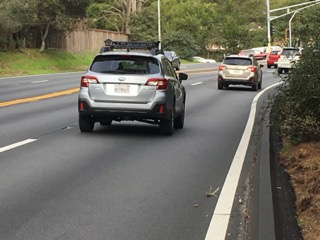
- Monterey-Salinas Highway (“68 East”); if you’re experienced and want to bike this scenic route, see some specific tips in this site’s “Serious Cyclists” section. You might want to ride with experienced bike commuters–who welcome beginners to join them–between the Monterey Peninsula and Salinas; see the Hwy 68 post.
- Hwy 1 south of Carmel, along the Big Sur coast.
- Carmel Valley Road, especially as you get further east of Hwy 1, away from the mouth of the valley (the mouth has four-lane stretches / wider roads); consider using bike-and-ride options to enjoy this beautiful area.
- Certain stretches of Pebble Beach (see Pebble Beach tips on this site).
- Holman Highway (“68 West”) from Hwy 1 to Pacific Grove.
Remember: Take advantage of the familiarity and experience that local resource people can share with you. Refer to Bicycling Monterey’s 33-section directory of Monterey County bicycling resources and bike community leaders (click here).
Short link to this page: http://bit.ly/WhereToBike


")

")


")
")


")