Posted by Founder, Bicycling Monterey
Monterey Bay Sanctuary Scenic Trail: Some updates
For the latest information about the Monterey Bay Sanctuary Scenic Trail Network:
- Santa Cruz County section, contact Santa Cruz County Regional Transportation Commission: http://sccrtc.org/projects/multi-modal/monterey-bay-sanctuary-scenic-trail/
- Monterey County section, contact Transportation Agency for Monterey County: http://www.tamcmonterey.org/programs/bike-pedestrian/ , e.g., http://www.tamcmonterey.org/wp-content/uploads/2018/01/MBSST-Presentation-to-BPC-May-2016.pdf.
* * *
Click here for a Transportation Agency for Monterey County brochure about the Monterey Bay Sanctuary Scenic Trail network, and click here for TAMC’s Master Plan. For some Santa Cruz County Regional Transportation Commission resources about this inter-county trail network—which will eventually stretch from the San Mateo-Santa Cruz County line to Pacific Grove in Monterey County—refer to SCCRTC’s webpage “Monterey Bay Sanctuary Scenic
Trail Network (Coastal Rail Trail).”
* * *
11/29/11 update: Public workshops Dec 13-15 in Watsonville, Santa Cruz, Davenport.
7/25/11 update:
Ribbon cutting ceremony for Beach Range Road segment on 8/31/11, part of Monterey County’s portion of the Monterey Bay Sanctuary Scenic Trail system.
What’s ahead for Monterey Bay region’s bikeways? And how to get around now….

There’s so much beauty in the Monterey Bay region! Just wish there were more miles of the bikeways not requiring constant vigilance about motorists!

Bikeways connecting Monterey and Santa Cruz Counties
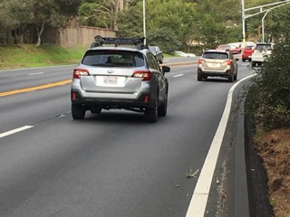
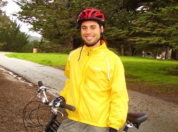
Above, a Santa Cruz County resident returns from a trip to his workplace, Community Hospital of the Monterey Peninsula.
Gosh, where is a cyclist gonna ride! It’s illegal, and dangerous, to bike against traffic. Yet this cyclist isn’t the first to have made a judgment call that on that uphill stretch in Moss Landing, he felt more at ease traveling as if he was a pedestrian. (It’s the law that pedestrians walk against motor vehicle traffic, and bicyclists ride with traffic).
Remember: riding against traffic, as he tried out above, is illegal and dangerous.

 I biked from Santa Cruz County to Monterey County as a Santa Cruz resident in years past. And like him, I’d have loved a safer stretch of bikeways connecting our counties. Hold that thought! It’s coming….
Thank you to the Santa Cruz Regional Transportation Commission for this April 2011 fact sheet providing updates on this project. And thank you to Congressman Sam Farr for championing this trail.
The vision for the trail is to have a multi-use system of bicycle and pedestrian facilities stretching from Lovers Point in Pacific Grove, Monterey County to the San Mateo/Santa Cruz County line. Check out the fact sheet to learn more.
Related resources
- Where to bike in Monterey County – route tips
- Tips for serious cyclists in Monterey County – routes and more
- Bike maps and more – for Monterey Bay Tri-County region and some other CA counties
- En espanol – includes above bike maps, plus some other California bike maps en espanol
Bikeways defined
Class 1 Bikeway (Bike Path): Provides a completely separated right-of-way for the exclusive use of bicyclists and pedestrians.
Class 2 Bikeway (Bike Lane): Provides a striped lane for one-way bike travel on a street or highway.
Class 3 Bikeway (Bike Route): Provides connections to either Class 1 or Class 2 facilities/bikeways. Class 3 facilities have no special lane markings, and bicycles share the roadway with motor vehicles.
These definitions provided courtesy of this Monterey County Planning Department glossary: http://www.co.monterey.ca.us/planning/major/eastgarrison/SP/1440SP_07_Glossary.pdf
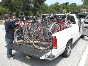
Existing bikeways: This is the life!
Ah….now here’s a super bikeway: An off-road bike/multi-use path in Monterey County, traveled by the Harrison family AKA Pedouins, who were en route from Kentucky to Alaska.
 Photo of the Harrison family courtesy of Steve E. Anderson.
Update: Offer your feedback to TAMC
The Transportation Agency of Monterey County has released this May 2011 document and requests public feedback: Monterey County 2011 Draft Bicycle and Pedestrian Master Plan.
 A Class 1 bikeway stretch of the Monterey Bay Coastal Trail – courtesy of Leo Kodl
This post was published on 26 May 2011. One or more changes last made to this post on 10 May 2019.


")


")


")
")


")