2. BIKE MAPS and Other Tools for Finding Your Way
This guide, provided as a public service, was first published in 2009, with many subsequent updates. For additional updates, or if you have questions, please contact us. To return to the portal page of the Tips for Bicycling Monterey County 20-section guide, click here.
Along with related tips,
this page features links to bicycle maps for:
-
Monterey County – countywide map: The most recent countywide bike map from the Transportation Agency for Monterey County is the 2023 edition, which is now available online and in print. Details: https://bikemonterey.org/2023-bicycle-map-for-monterey-county.html
-
Monterey County – additional maps: Salinas, the Monterey County seat and its largest city; California State University-Monterey Bay; Fort Ord National Monument; Velo Club Monterey ride maps; and a general representation map of the 1.5 mile South Bank Trail along the Carmel River.
-
Maps for Monterey Bay region’s San Benito and Santa Cruz Counties.
-
Maps for Central Coast counties of San Luis Obispo and Santa Barbara.
-
Maps for San Francisco Bay area.
-
Maps for some other areas of California.
Spanish language versions are often included.
Related tips on this page include:
- Bike-and-ride and transit connections.
- Definitions of types of bikeways.
- Route help websites.

You may be familiar with pedestrian-heavy sections of Monterey County’s Class I bike-pedestrian/multiuse paths near popular areas like the Monterey Bay Aquarium and the wharfs. But did you know about the wide open spaces, like this section near Fort Ord Dunes State Park?
And on former Fort Ord land, there are also many miles of paved roads where cars are not allowed. See the “Fort Ord National Monument” heading below for links to maps and related resources.

Above: Pretty nice, eh? Two lanes for bikes and a separate lane for pedestrians.
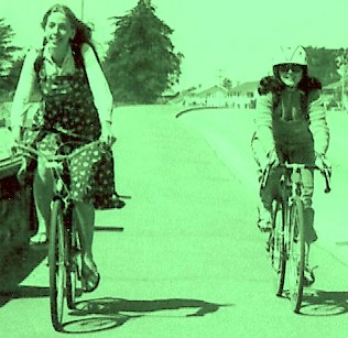
Below: The Harrison family, AKA Pedouins, appreciate the many car-free miles of Monterey County’s section of the Monterey Bay Sanctuary Scenic Trail. (Photo courtesy of Steve E. Anderson)

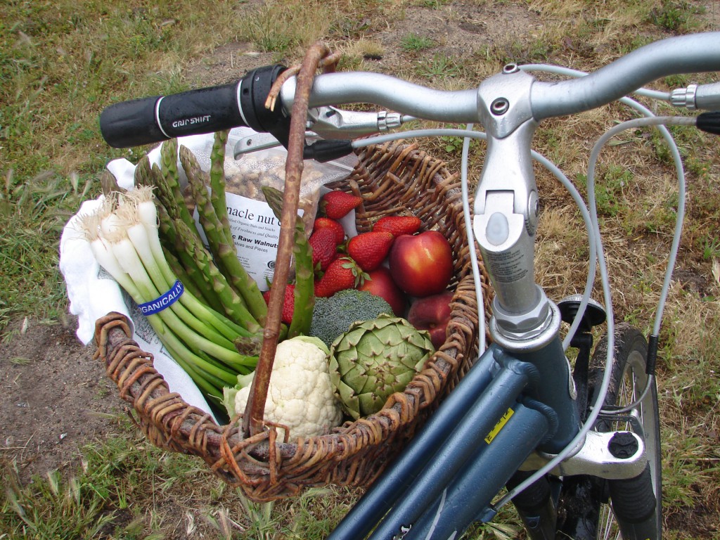
Once you start biking here…
You may not want to stop. So, here are maps and other info to help keep you going!
Also on this site, see the “Where to Bike in Monterey County” and “Serious Cyclists” sections of the Tips for Bicycling Monterey County guide.
For additional help, refer to Bicycling Monterey’s main resources page.
Bike-and-ride to expand your territory
Not so sure how far you want to go? You may find the routes of Monterey-Salinas Transit (MST) buses, or other bike-and-ride transportation for you and your bike, can make it easier to experience Monterey County. Refer to our “Bike-and-Ride” section for some tips on MST, Amtrak, Monterey Airbus, and other transportation helpers.
MST has “Bicycle loading instructions” in their “Rider’s Guide/How to Ride/Transit Tips” section, and then refers to Bicycling Monterey for more bicycling tips.
Transit connections
Bike-and-ride options that go out of the county, like Amtrak and MST transit connections, mean you can use Monterey County as a homebase as you bike throughout the region too. Some tips on doing that are also found in the “Bike-and-Ride” section.
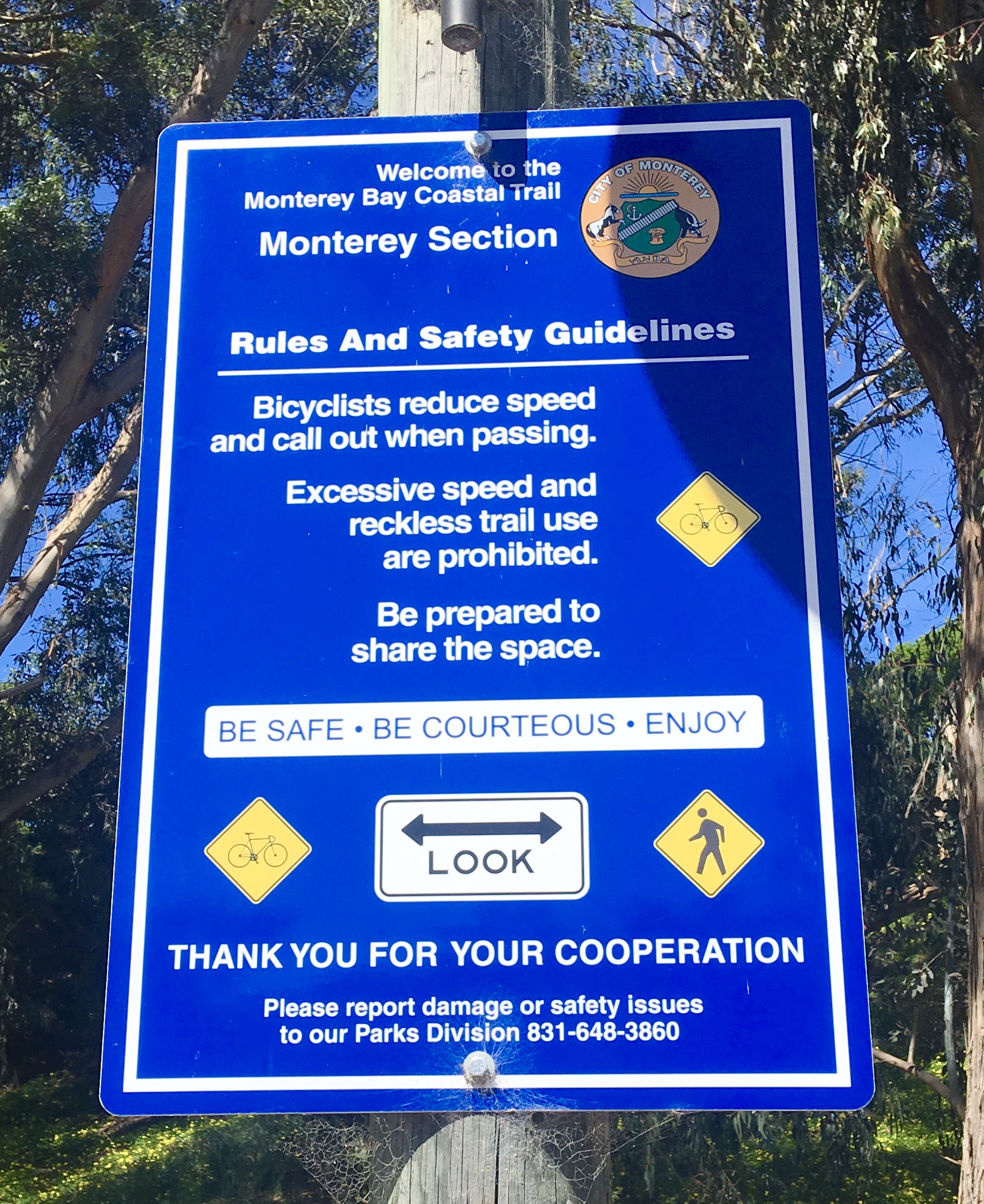
Traveling to Monterey County communities of Castroville, Marina, Seaside, Sand City, Monterey, and Pacific Grove? Make use of Monterey County’s coastal trail system. The Monterey Bay Coastal Recreation Trail is part of the Monterey Bay Sanctuary Scenic Trail network.


* * *
Help support the work of Bicycling Monterey, provided as a public service since 2009, by making a
contribution in any amount. See how to contribute and FAQs.
* * *
Monterey County’s bike maps
You may be aware of the 18-mile stretch of the Monterey Bay Coastal Recreation Trail, from the Castroville area to Lovers Point in Pacific Grove. It’s popular because of overall freedom from motor vehicles as well as beautiful views along the coast. And it’s part of the Monterey Bay Sanctuary Scenic Trail Network. For more info about this network, start here: https://bikemonterey.org/monterey-bay-sanctuary-scenic-trail.html
Where are the other Monterey County
bikeways, and the most accurate, reliable bike maps?
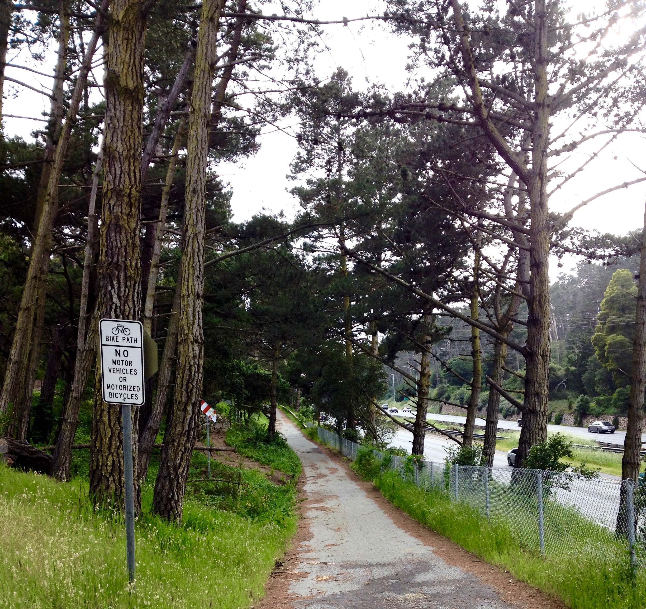
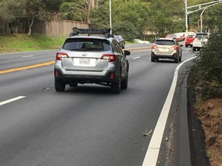
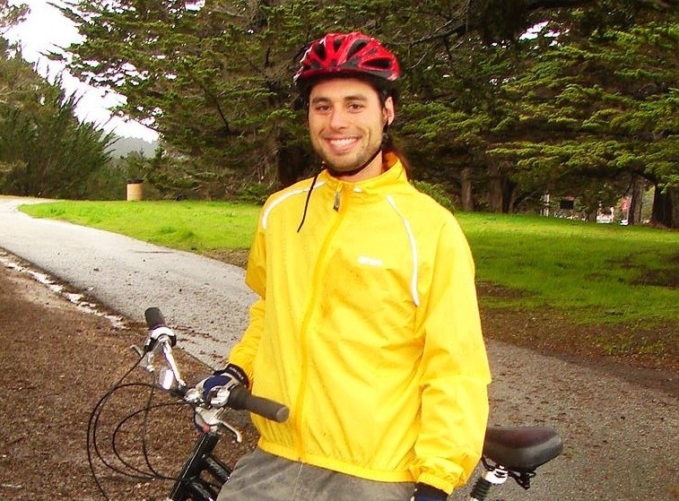
Australian Carey Beebe bikes to Bach in Monterey County annually. The bikeway above, parallel to Highway 1 heading south toward Carmel, is one of the many routes he takes to multiple Carmel Bach Festival locations around the county. Because Carey has biked here for 21 summers as of 2019, he doesn’t really need a map anymore. But many visitors, and locals, do find the bike maps helpful.
Monterey County’s countywide bike map
The most recent countywide bike map from the Transportation Agency for Monterey County is the 2023 edition.
-
Monterey County – countywide map: The most recent countywide bike map from the Transportation Agency for Monterey County is the 2023 edition, which is now available online and in print. Details: https://bikemonterey.org/2023-bicycle-map-for-monterey-county.html
Print maps can sometimes be picked up at local bicycle shops, local visitor centers, chambers of commerce, city offices, public libraries, and other locations.
City of Salinas bike map
The City of Salinas has its own Bicycle Facilities Map, in English and Spanish. As the city’s site says, some of their “maps might take a minute to load.” Refer to https://www.cityofsalinas.org/Your-Government/Maps-and-GIS/Bikeways.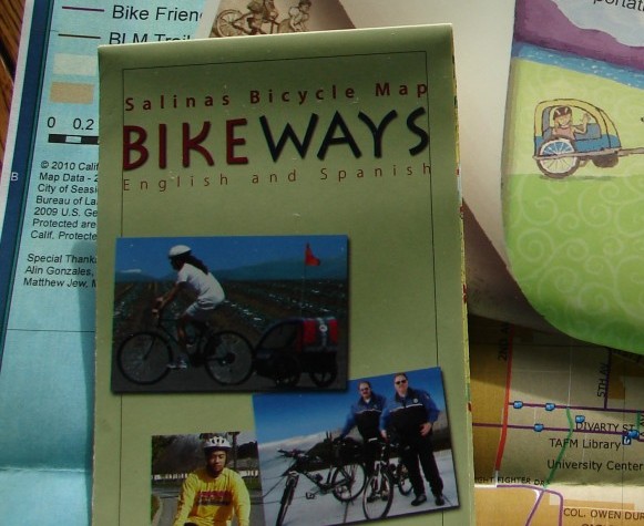
CSUMB bike map
California State University Monterey Bay created a CSUMB-specific bikeways map, and it includes Spanish and English text. It also has a “Hot Destinations” guide, to help direct you to 33 popular points of interest.
bike_map_2012_final_print_spanish_1 [English y en espanol]
Check out CSUMB’s bicycling resources sections, e.g., https://csumb.edu/transportation/bicycling/ and https://csumb.edu/police/alternative-transportation-safety-initiative/. 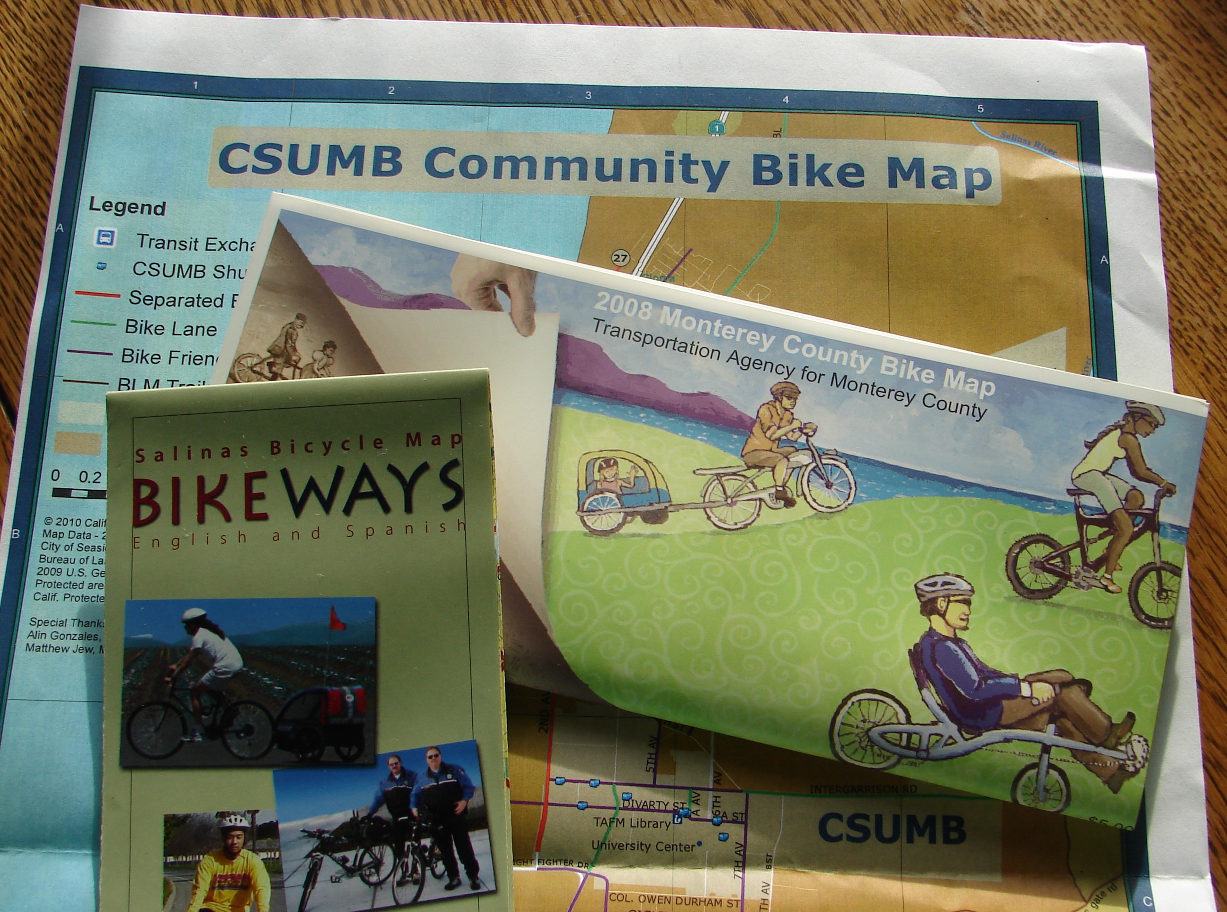
Fort Ord National Monument
Fort Ord National Monument has beautiful vistas for people biking both roads and trails. Whether you’re a roadie or a mountain biker, make use of this public land.
To access Fort Ord mountain bike trail maps—plus tips for mountain biking—visit the Monterey Off Road Cycling Association (MORCA) website, MORCAmtb.org. MORCA has a local trails section with trail maps, trail info, and trail apps: http://morcamtb.org/local-trails/
Paper maps may be available at the information kiosks throughout Fort Ord, or contact the Bureau of Land Management’s Central Coast Field Office https://www.blm.gov/office/central-coast-field-office to request that one be mailed to you.
Bureau of Land Management (BLM) website: http://www.blm.gov/visit/fort-ord-national-monument
Velo Club Monterey Ride Maps
Routes regularly taken on Velo Monterey’s group rides may be accessed via the “Ride Maps” section of their website: https://veloclubmonterey.wildapricot.org/Local-Rides. You’ll find maps for the popular “Monterey Loop” (100 miles), their Saturday Morning ride, and their No Real Job ride. (For the latest Fort Ord map—Fort Ord is popular for road biking as well as mountain biking—refer above or to MORCAmtb.org.)
South Bank Trail – Carmel River
As the Palo Corona Regionial Park map states, no bicycles are allowed except on the South Bank Trail. https://www.mprpd.org/files/f0bf66214/PaloCorona-Map_1122.pdf. This 1.5 mile Class I trail, because of its brevity, is best suited for those who will appreciate its positive features in spite of its short length. Have little ones who like to veer off other Class I trails? No problem here; there are fences on each side. Note that to reach this trail, first you must travel a stretch of road between the 6-vehicle parking lot and the trailhead. That road is often very quiet.
About the park: https://www.mprpd.org/palo-corona-regional-park Some history: Kera Abraham’s Monterey County Weekly 12/15/11 story, “Trail to Heaven.” https://www.montereycountyweekly.com/news/831_tales/big-sur-land-trust-s-latest-pathway-project-charms-locals-leads-to-palo-corona/article_7f3073d4-fa0d-553b-813b-bfc82db083ab.html
Related info: https://bigsurlandtrust.org/carmel-river-free/
Map tip: Bikeways defined
Refer to “Where to Bike in Monterey County” for definitions of the types of bikeways referred to, e.g., bike paths, lanes, and routes, Class I, II, III, and IV.
Below: Class I bikeways include the majority of the 18-mile Monterey Bay Coastal Trail.
Photo below courtesy of Leo Kodl.

Monterey Bay Tri-County Region
(Monterey, San Benito, and Santa Cruz Counties)
- Monterey County maps are provided above.
- San Benito County’s bike map: http://sanbenitorideshare.org/wp-content/uploads/2012/12/San-Benito-County-Bike-Map.pdf – San Benito County maps (click here to download PDF) – The Council of Governments is San Benito County’s regional transportation planning agency. For Council of Governments bike projects, click here.
- San Benito County also has, in English and Spanish, Safe Routes to Schools brochures featuring maps of suggested bicycling and walking routes to each individual school.
- Santa Cruz County maps (click here, then refer to RTC Bicycle Maps) – For the Santa Cruz County Regional Transportation Commission bike projects, click here.
- Santa Cruz County – Also refer to People Power Santa Cruz resources – provided by the organization now known as Bike Santa Cruz County, the Santa Cruz Hub for Sustainable Transportation projects, Bike Shack in Watsonville, Bicycle Planning, Programs, and Services at the University of California at Santa Cruz (UCSC), Ecology Action of Santa Cruz transportation resources, and Santa Cruz County Cycling Club.
Santa Cruz County Regional Transportation Commission (sccrtc.org) has a video on how to use their map.
Additional Central Coast bike maps
- Santa Barbara County https://www.trafficsolutions.org/SBC-BikeMap – also refer to the Santa Barbara Bicycle Coalition
- San Luis Obispo County – Refer to Bike SLO County – https://bikeslocounty.org/resources/maps/ and San Luis Obispo Bicycle Club
Visit the California Department of Transportation (CalTrans) District 5 Bicycling page for a downloadable version of their Bicycle Touring Guide. The CalTrans site has other bike maps and resources; click here to start exploring their site.
Headed north of the Monterey Bay area?
For the San Francisco Bay area, refer to 511.org and to the San Francisco Bicycle Coalition.
Maps en espanol–
including additional California cities and counties
Refer to the Spanish language resources on this site, found under the “Resources/Los Recursos” tab.
Other California bike maps
Pacific Coast Bike Route
The California Coastal Commission’s California Coastal Trail map includes the Pacific Coast Bike Route. Click here to learn more about the California Coastal Trail.
If you purchase a Pacific Coast Bike Route map or guide book from a resource such as Adventure Cycling Association, be aware that mistakes may sometimes appear. (Example: See camping section of this site.) Ask a local.
California Bicycle Coalition
See the California Bicycle Coalition (CalBike.org) Maps page: https://www.calbike.org/go_for_a_ride/map_routes/
Below: Monterey Institute of International Studies (now Middlebury Institute) student Sue Kim is already quite at home on the bike/multi-use path.

 Lisa Hoch, visiting from Eussenhausen, Germany
is backed up by her friends the Besse family of Scotts Valley, California, as she makes her first exploration of the bikeways of Monterey.
More tips for finding your way
Route help websites
As noted in the Where to Bike in Monterey County section on this site, you may want to make use of the following:
Be aware there are sometimes errors in such computer-generated directions. These can be made better by knowledgeable people who bike taking time to contribute corrections and suggest alternate routes.

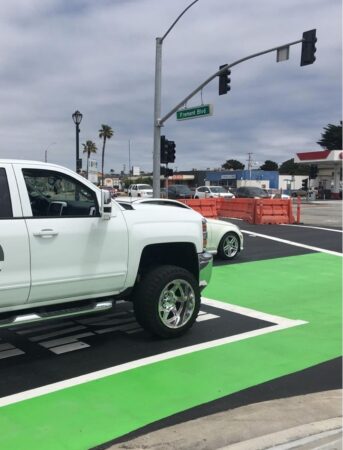
The American Automobile Association’s photo above reminds drivers that bicycling is another way people travel.


")

")


")
")


")