Posted by Founder, Bicycling Monterey
Transportation Agency updates: (1) Via Salinas Valley – Pathway to Health; (2) Wayfinding Signage and Updated Bicycle Map; (3) Bike and Skateboard Parking and a Bike Repair Station Coming!
March 2021 update on progress with Wayfinding project:
Transportation Agency for Monterey County (TAMC) @TAMC_News board vote 3/24/2021 on Pedestrian and Bicycle Wayfinding Program Regional Funding Agreement: 920 signs for "369 miles of safe routes by bicycles and pedestrians."https://t.co/AEaudfa3d2 Item 3 2.1
Attn: @BikeMonterey— Kevin Dayton (@DaytonPubPolicy) March 22, 2021
The post below was first published on August 7, 2015.
By September 18, 2015, give input on Wayfinding sign design and and Bicycle Map layout. Details about options for doing that (including for people not online and Spanish speakers) are on the http://bit.ly/BikeCalendar. Below, learn about Wayfinding and the Bicycle Map update.
The info below was previously published 4/26/15.
1. A New Pathway to Health Initiative in the Salinas Valley
[Note: Green text in this post was provided by TAMC.]
The Transportation Agency for Monterey County and the Monterey County Health Department have forged a new partnership with cities in the Salinas Valley in a regional effort to improve health, access, and safety. Known as “Via Salinas Valley: Pathway to Health,” this health initiative was funded through an Active Transportation Program State grant and is designed to provide additional healthy transportation choices for residents of the cities of Gonzales, Greenfield, King City, Soledad, and Salinas.
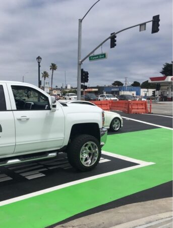
The construction of new infrastructure in these communities will make safety improvements that will result in safe places to walk and bike, reduce automobile speeds and traffic volumes, and improve access to schools, parks, and other key destinations. The benefit of providing the means to support a more active lifestyle can lead to healthier families and healthier communities in the Salinas Valley.
[Editor’s notes: Bicycling infrastructure changes include bicycle facility markings in Greenfield and multi-use paths and bicycle lanes in King City, as well as new bike lanes in Salinas. Click here for details, as well as other infrastructure improvements ahead for Gonzales and Soledad.]
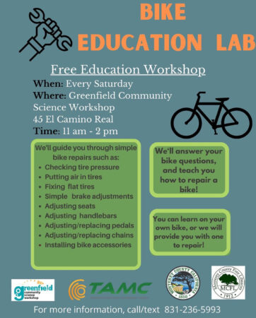
Update: MacGregor Eddy reports on Greenfield infrastructure needs in the Salinas Californian 10/20/16, “A safer route to school for Gerardo, friends.” The link in her story for more info about Safe Routes to School goes to a TAMC document Transportation Safety & Investment Plan / Measure X, which is on the 11/8/16 ballot for Monterey County voters. To learn more about Safe Routes to School and related info, type “safe routes to school” in your browser find window in Bicycling Monterey’s post Bike to School: Elementary, middle, and high schools in Monterey County.
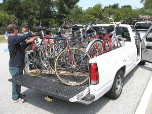
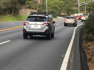
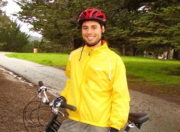
The bike-to-work commuter below is a Greenfield resident. Click here for tips on on biking Greenfield, along with a list of the first HER Helmet Thursdays spots in South County cities. Click here for bike Salinas tips and HER Helmet Thursdays spots in our county seat.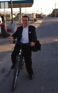
2. Bicycle and Pedestrian Wayfinding Signage, and Bicycle Map Update
[Update: As mentioned in the Transportation Agency for Monterey County 1/4/17 bike-ped committee packet, on page 18 http://www.tamcmonterey.org/wp-content/uploads/2016/12/BPC_Packet_January_2017.pdf, TAMC’s Wayfinding project was among those projects not awarded funding in the CA State Active Transportation Program Cycle 3 grant funds. Check with TAMC for later Wayfinding project updates.]
What Wayfinding sign design would be best for people who bike and walk in Monterey County? By end of day on Monday, June 15, give your input to bilingual (Spanish-English) Virginia Murillo via email or phone, or if you’re able, via the “mySidewalk” (formerly MindMixer) web application. Deadline has been extended from the original date of June 11.
Contact Virginia too if you need help or have questions. Details, including a link to mySidewalk, at http://tamcmonterey.org/programs/bikeped/wayfinding.html
habla español Virginia Murillo, Assistant Transportation Planner, TAMC, 55-B Plaza Circle, Salinas, CA 93901; phone 831.775.4415; email virginia@tamcmonterey.org
Learn more below, and also via the Power Point presentation made June 4, 2015 by TAMC contractor Alta Planning + Design; download 38-page PDF: http://www.tamcmonterey.org/programs/bikeped/pdf/WayfindingPlanAdvisoryCommittee-PresentationJune42015.pdf
Finding your way around Monterey County is going to get a lot easier in the near future with new Wayfinding signage for people who bike and walk. At the TAMC Board Meeting on April 22, 2015, Alta Planning + Design was selected to design regional bike/walk Wayfinding signage and to update the Monterey County Bicycle Map.
Elements of the new Wayfinding signage will include gateway signs, directional signs, confirmation signs, and turn signs that can be mounted to existing signs, as well as pavement markings. All of these elements, including the exploration of orientation maps, decorative sign toppers, and mile markers, are designed to make it easier to use the region’s healthy transportation network. The public is welcome to participate in identifying preferred regional bicycling routes and develop the Wayfinding signage that will help users find the easiest routes to popular destinations and activity centers. An online forum has been set up at: http://tamc.mindmixer.com/.
[Editor’s note: The web app formerly known as MindMixer has now rebranded as mySidewalk; grab the link to it on TAMC’s website: http://tamcmonterey.org/programs/bikeped/wayfinding.html
[Editor’s notes: (1) There are alternatives to providing input via mySidewalk. Options include those for people not online as well. You may provide input by phone or email to TAMC’s Wayfinding Plan contact person, Virginia Murillo. Virginia is bilingual (Spanish-English). There are Ad-hoc Wayfinding Plan Advisory Committee meetings, and public attendance is welcome; click here for details. Can’t get there? Ask Virginia about call-in options for participating in these meetings. (2) The public is also welcome to attend any TAMC Bicycle and Pedestrian Facilities Advisory Committee meetings; see dates, agendas, and minutes here. Wayfinding Plan will be on the agenda often, and whenever it is not, you are still welcome to share your input during public comment period. (3) You may also wish to get on the email list for the Wayfinding project by contacting Virginia Murillo, Assistant Transportation Planner, TAMC, 55-B Plaza Circle, Salinas, CA 93901; phone 831.775.4415; email virginia@tamcmonterey.org]
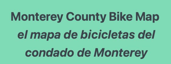
An update version of TAMC’s popular printed bicycle map will be one product of this effort. The update bicycle map will include the latest bicycle routes and an updated legend with color-coded bicycle routes and icons.
[Editor’s note: For reference, click here for TAMC’s most recent bicycle map. It’s important to many people that all areas of the county are covered in the next TAMC bike map, as noted in the comment on our Bike Castroville tips. Communicate to Virginia Murillo, TAMC’s Bicycle Facilties Map contact person, any input you have about the bicycle map update.]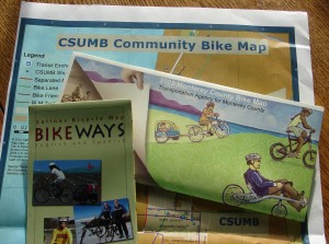 For more bike maps, see Bicycling Monterey’s bike maps section. You may also wish to refer to Where to Bike in Monterey County.
3. Bicycle Secure Program Applications Approved
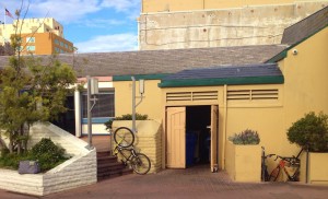
Help is on the way to provide more parking for people who bike and skateboard, as well as a bike maintenance/repair station. On April 22, 2015, the TAMC Board of Directors approved $30,000 in funding for ten Bicycle Secure Program applications and the partial funding of an application for an artistic bicycle rack design.
The Agency received applications from California State University-Monterey Bay, Greenfield, King City, Monterey, and Salinas. [Editor’s note: For locations, scroll to page 13 of the April 2015 bike/ped committee meeting packet.] The requests include the funding of 40 bicycle parking racks, 5 bicycle shelters, 1 bicycle repair station, and 8 skateboard racks. Combined, the bicycle racks can accommodate approximately 150 bicycles and the skateboard racks can accommodate approximately 90 skateboards.
Now that the funding has been approved, it’s just a matter of the time required for ordering the items and having them installed. The end result offers security and a safety net to those who bike or skate to get around in Monterey County.
[Editor’s note: Ah! Didn’t know about the opportunity to apply for free bike and skateboard parking and bike repair station? Information was posted on the Bicycling Monterey website in January, and the deadline to apply was March 5, 2015; click here for details, then get in on the next application period.]
You may also wish to refer to the following sections of the Tips for Bicycling Monterey County guide: Bike Valet and Other Bicycle Parking–including Etiquette and Laws and Bicycle Security, including Unique List of Places to Go.
The above information was provided courtesy of Theresa Wright, Community Outreach Coordinator, Transportation Agency for Monterey County. Contact Theresa at 831.775.4411 or via email at Theresa@tamcmonterey.org.
Chart below © SeattleGreenways.org and shared at the April 2015 Women Bike, Women Lead event in Los Angeles. Learn more in “How smart language helped end Seattle’s paralyzing bikelash” on the People for Bikes website.

The Bicycling Monterey website and projects were established May 2009. They are provided as a public service, in collaboration with the community. Your support for this grassroots bike advocacy effort is appreciated.
Make a contribution in any amount.
This post was previously published 4/26/15.
This post was published on 7 August 2015. One or more changes last made to this post on 25 March 2021.


")


")


")
")


")